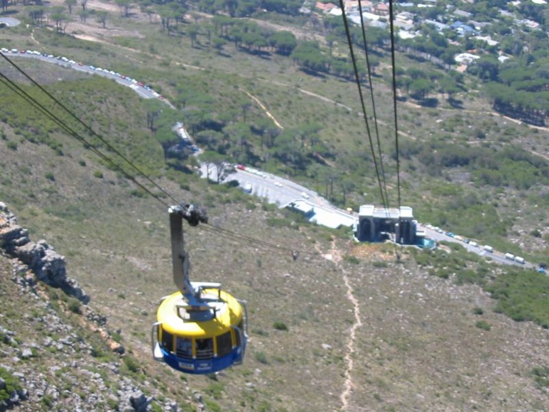
This hike usually starts from the Camps Bay side of Table Mountain, but we did a 'round trip' and parked our car at the lower Cable Station. We also 'cheated' a bit and came down with the cable car. As parking is at a premium, to get close to the Cable Station, you have to get there early.
Kasteelspoort translates as Castle's Gate.
Requirements
Water - 2 liters. Water is available at the start of the pipe trail.
Warm clothing and rain mac.
Route map.
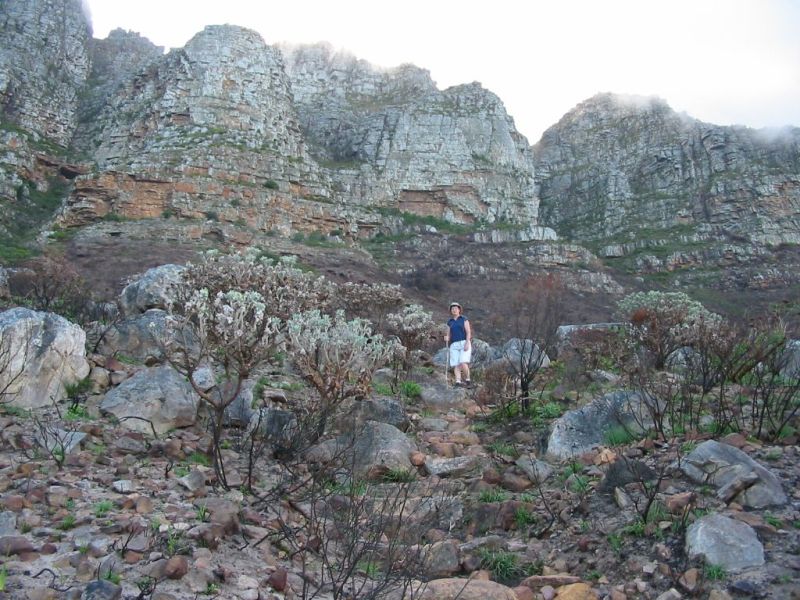
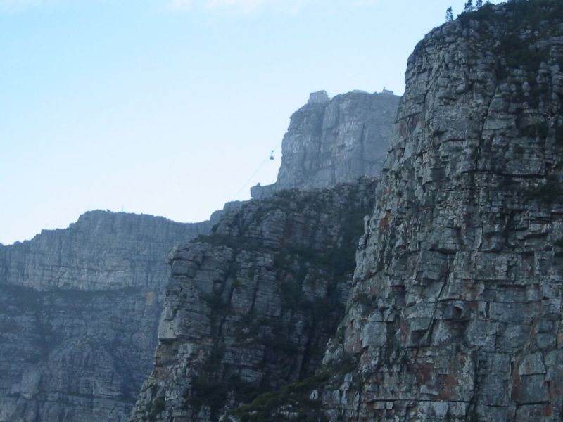
Walk down Tafelberg Road towards Kloof Nek - the way you came by car. Depending on where you parked, you should reach Kloof Nek and the start of the Pipe Trail after about 10 minutes. Follow the Pipe Trail, this is a lovely walk, and is is quite level, the only steep bit is Diep Kloof. You should reach Diep Kloof 15 minutes after the start of the Pipe Trail, Blinkwater Ravine 25 minutes after that and the start of the Kasteelspoort trail 10 minutes after Blinkwater.
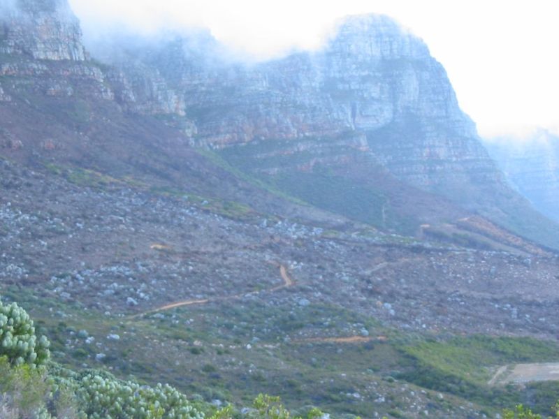
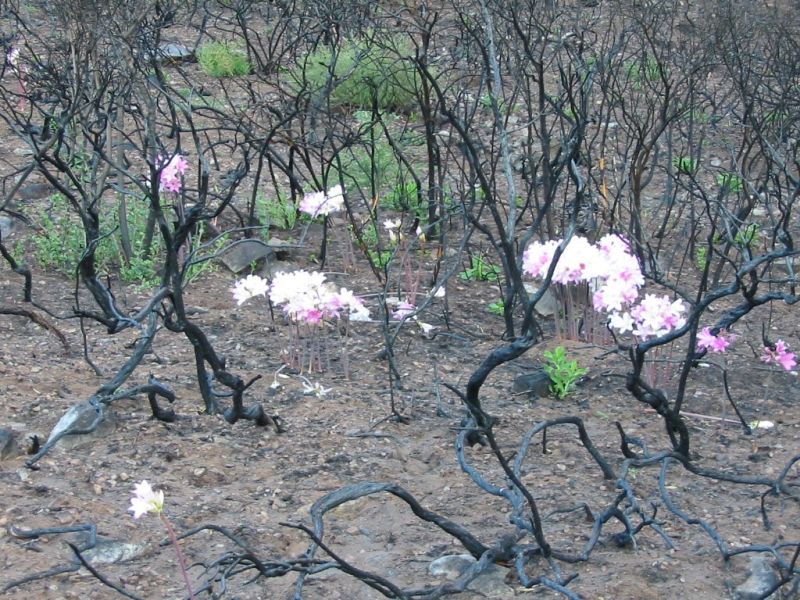
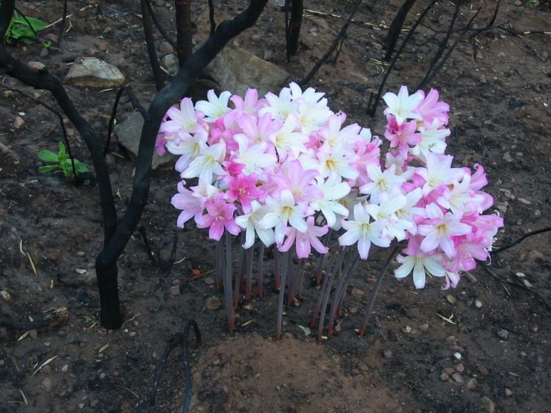
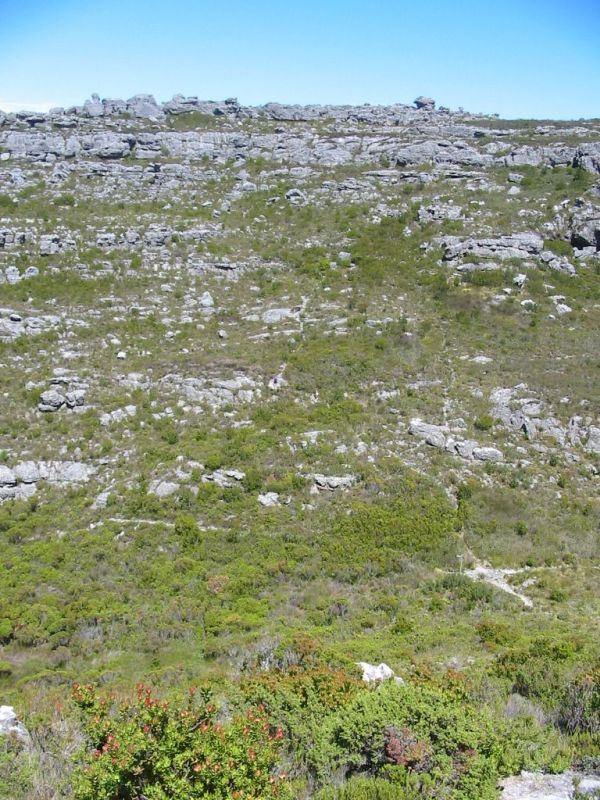
This area was severely burned by a bush fire in January 2003, and some of these pictures were taken just after the fire, in February. In particular, Fire Lilies are dotted about and March Lilies abound, giving a splash of color to the blackened areas.
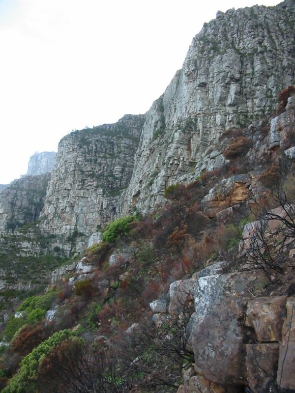
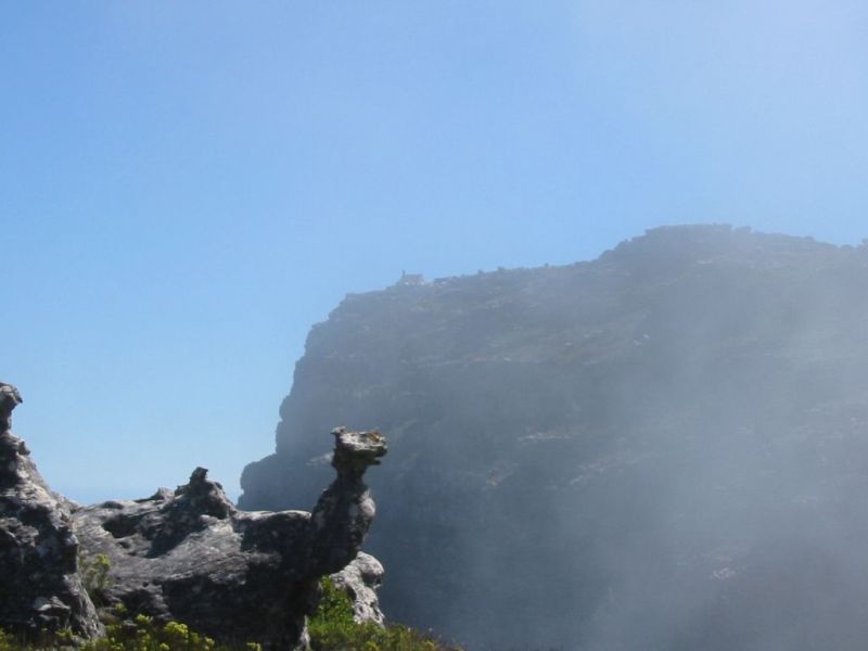
The path climbs steadily upwards and is not very strenuous. There are some easy ledges to navigate, but again, these are quite easy and not dangerous, provided care is taken. The good thing about this route, is that (provided you have started early) it is still in shade till nearly to the top of Kasteelspoort. The views are breathtaking and you see Camps Bay unfold as you ascend. The day these pictures were taken there was a bit of mist on the mountain and a strong wind came down Kasteelspoort, making it quite cool. You should reach the top of Kasteelspoort about 40 minutes after leaving the Pipe Trail
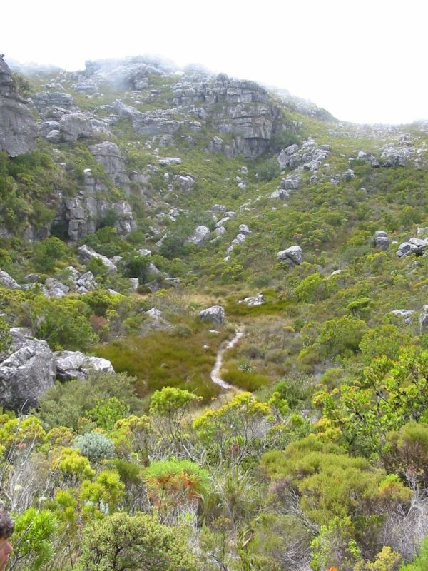
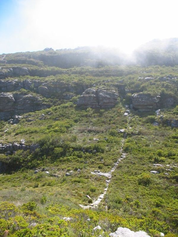
Here the path splits, to the right to Grootkop (and further) and left to the Valley of the Red Gods. Take the left hand path and soon you will encounter another path to the right, going to some buildings. Ignore this path and keep going till you find the next sign, showing the way to Platteklip Gorge. You are now in the Valley of the Red Gods. The path leading off to the left takes you down the mountain via the Diagonal Path. For now follow the way indicated to Platteklip Gorge. Here the fynbos is quite dense and the path more overgrown.
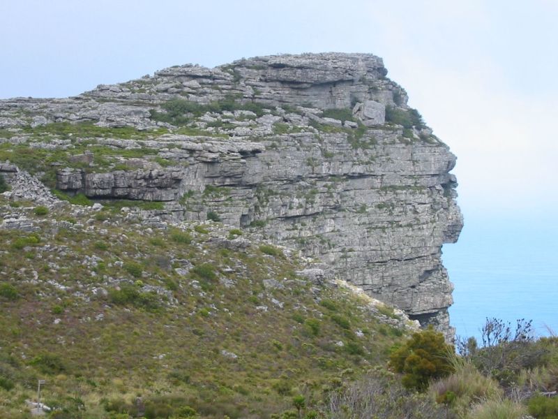
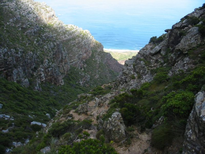
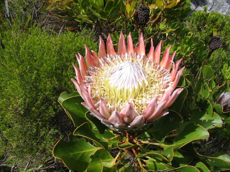
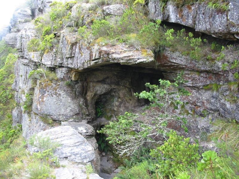
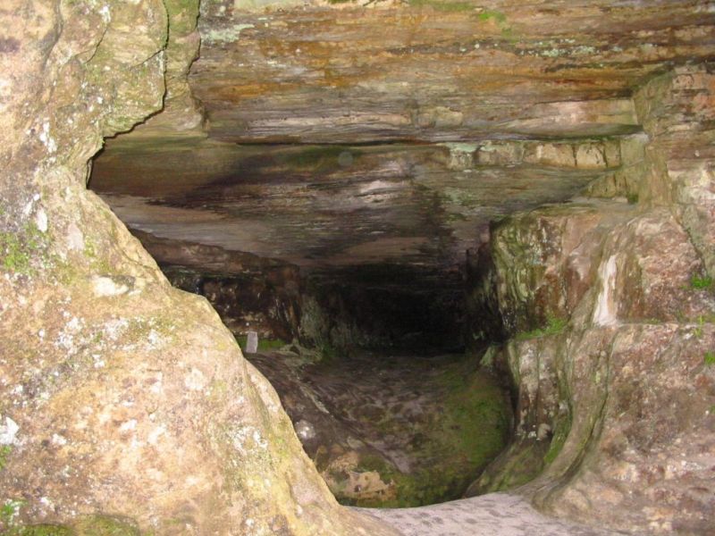
After crossing the rise, you will see the Valley of Isolation below you. This is 30 minutes after the top of Kasteelspoort. this valley is aptly named, as it is surrounded by ridges. At the far left end, there is a large cave on a ledge. With a bit of rock scrambling, you can get into the cave, but be careful, as the rocks are slippery and a fall will spoil your day. There are also a fair number of large Protea (Cynaroides) in the valley.
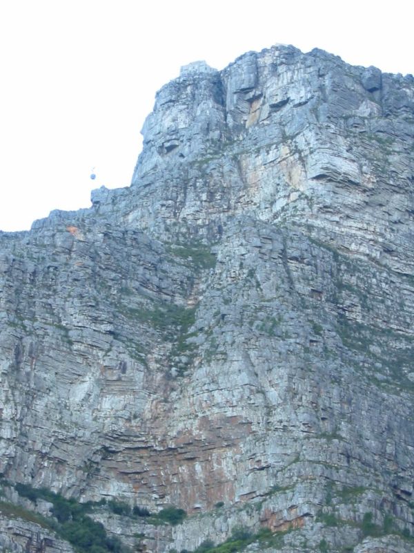
Over the ridge and you walk into Ark Valley. Here the path splits left, right and straight ahead. All the paths eventually takes you over the next ridge in Echo Valley, but the left hand one is the correct one. Just make sure to make your way over the ridge and not down the mountain. On top of the ridge, one looks down into Echo Valley and the path up the last stretch via the three ladders to the top of Platteklip Gorge. At the bottom of Echo Valley, is a 4 way split, with the left path to the now closed Blinkwater Ravine. The right hand one to Maclear's Beacon( the highest point of Table Mountain - 1085.9 meters), Skeleton Gorge and the reservoirs.
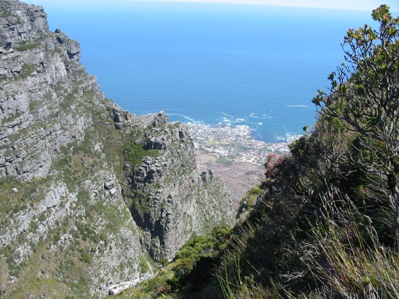
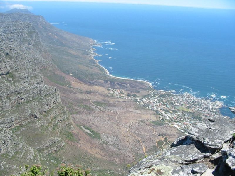
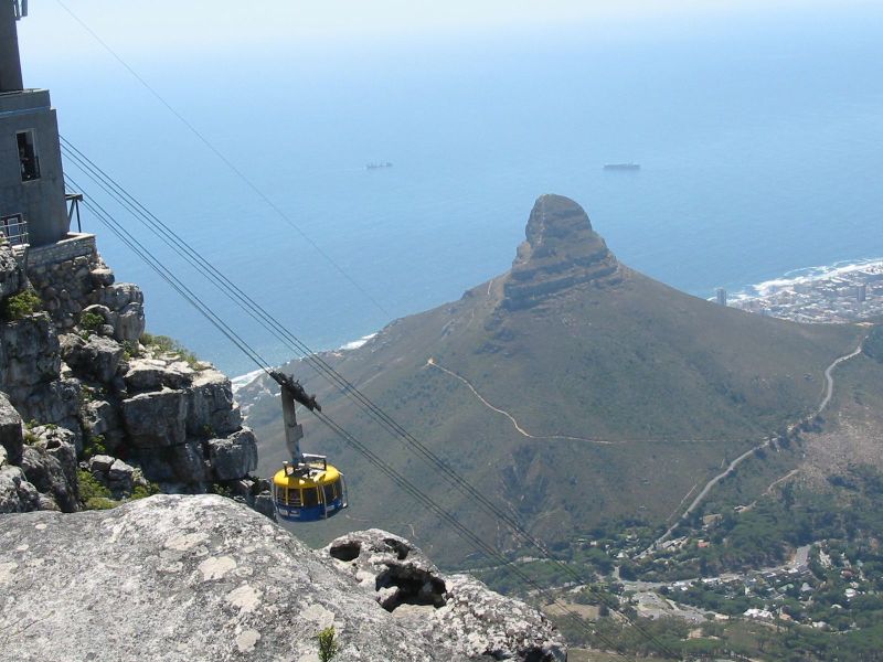
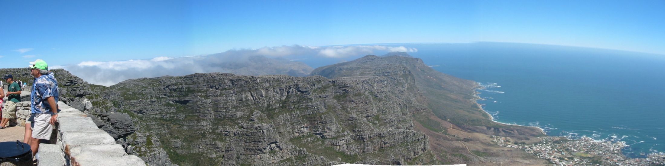
After ascending the ladders and some wooden pathways, you reach the top of the table with the restaurant a welcome sight!. Here is a souvenir shop as well. You can also do abseiling, as there is a organized club here. From here you can see the way you came as well as spectacular views of Camps Bay, Sea Point, Lion's Head and on the other side, Cape Town, the Waterfront and Devil's Peak. If you are lucky, you'll see some Dassies (small brown furry rodents the size of a large cat) that are found here. The are completely harmless and love to sunbathe!
After you have finished you tour of the mountain, you can either take the cable car down, or as a alternative, go down Platteklip Gorge. The total time of the hike from you car to the restaurant should take no more than 5 hours. |